07/06/2016

Past, Present, Future: How Human Evolution And Climate Are Linked

The Conversation - 

Fire significantly added to our ability to change the world. Fire image from www.shutterstock.com

Over the past year, carbon dioxide (CO₂) levels in the atmosphere have risen faster than any period in the past 55 million years. That's the finding of my study published in Global Change Biology.
From April 2015 to April 2016, CO₂ levels rose by 4.6 parts per million (ppm), reaching a level of 407.42ppm at Mauna Loa observatory, Hawaii. This rate has increased in the past 200 years and forms a unique spike, reflecting accelerating global warming reinforced by the recent El Niño.
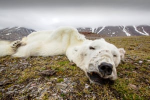
CO₂ levels above 400ppm have not been observed in the Earth's climate record since the Pliocene, 5.3-2.6 million years ago, when sea level was about 25 metres higher than at present.
While climate change has gained scientific attention in the past 50 years, and political action in the last 25, humans have been altering the atmosphere much longer than that.
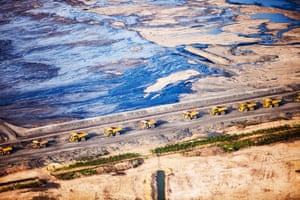
About 7,000 years ago, the development of agriculture, burning and land clearing is believed to have led to a small rise in CO₂ in the atmosphere (around 20-25ppm). Methane also rose by a small amount from 5,000 years ago.
These small rises didn't lead to increasing temperatures, because the overall temperature trend until the 18th century was cooling.
Humans have since increased CO₂ from 280ppm before the Industrial Revolution to over 400ppm. Together these global changes, driven by our use of energy, have led scientists to define a new geological age, the Anthropocene.

A new age
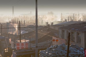
Although not yet officially recognised, the Anthropocene is widely considered to have begun in the 18th century with the release of greenhouse gases (CO₂, methane and nitrogen oxides), land clearing, chemical pollution and other human activities. These changes have accelerated since the 1950s.
Some think the Anthropocene began much earlier, linked to the first rise in greenhouse gases around 7,000 years ago. In evolutionary terms, it can be suggested the blueprint for anthropogenic global warming originated earlier still with the harnessing of fire.
The only natural parallel with the speed of climate changes over the last few decades is during mass extinctions, when the pace of change exceeds the ability of species to adapt. Mass extinctions in the past have been triggered by large-scale volcanic events or asteroid impacts.
This time it's us causing the changes. The unique ability of an organism to trigger a mass extinction has a possible precedent in the history of Earth.
As US palaeontologist Peter Ward explains in Under Green Sky (2008), the Permian-Triassic mass extinction (about 251 million years ago) was, at least in part, caused by toxic gas released by purple-green algae from the oceans.

Fire and ice
What has made humans so effective at causing environmental change? There are two essential factors.
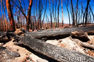
First, with the exception of humans, no species has ever been able to harness combustion in order to magnify its energy output. Humans mastered fire at least 1 million years ago, and possibly earlier.
Fire has allowed us to cook. Consequently, we were able to increase our protein consumption, hunt, protect ourselves from cold and wild animals, move into inhospitable climate, clear the land, smelt metals and construct machines.
Fire vastly increased the amount of energy available for people to use. Human respiration dissipates 2–10 calories per minute, a camp fire covering one square metre releases approximately three to four orders of magnitude more, and the output of a 1,000 megawatt-hour power plant expends yet higher orders of magnitude than the energy produced by human respiration.
Second, humans have been blessed by a relatively stable climate over the past 7,000 years, although mean global variations of less than 1℃ were sufficient to cause serious disruption to agriculture and a decline to collapse of civilisations.
Ice core evidence for the concentration of greenhouse gases and atmospheric temperatures during the last 740,000 years suggests highly unstable and often extreme climates during the ice ages (glacial) and during abrupt cooling phases (called "stadials") during warmer (interglacial) periods, preventing the development of farming.
A stable climate developed around 7,000 years ago. This allowed large-scale Neolithic production of extra food and thereby the emergence of villages, towns and later cities. This opened the way for Homo sapiens to expand its population and trigger energy output by huge amounts.
Thus, despite their high intelligence, humans were largely restricted to hunting and gathering until they mastered fire and then until the climate stabilised enough to allow farming.

The future
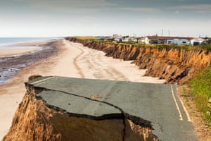
Since the onset of the industrial age, humans have released more than 600 billion tonnes of carbon, pushing mean global temperatures up by around 1°C globally, or 1.5°C on the continents.
Allowing for the cooling effects of sulphur aerosols (which reflect sunlight), the rise in temperatures is closer to 2°C, a mean global temperature similar to the Pliocene (2.6 - 5.3 million years ago). More recently the rise of atmospheric CO₂ accelerated, to rates higher than 3ppm per year during 2012-2016.
While we know a lot about what may happen in a warming world, widely agreed projections of future temperatures do not include the possibility of abrupt climate tipping point events.
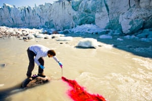
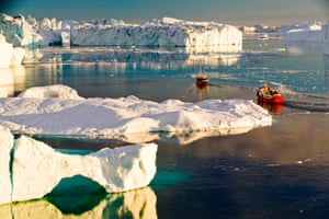
Following the peak of previous warm periods, the Atlantic Mid-Ocean Circulation (AMOC) has repeatedly collapsed due to the melting Greenland ice sheet and flow of cold meltwater into the ocean, triggering much colder temperatures, followed by further warming. Examples are the cold Younger Dryas (12,900-11,700 years ago) and the collapse of the North American ice sheet about 8,200 years ago.
A future AMOC collapse may be signified by a growing cold region southeast of Greenland in the North Atlantic. An AMOC collapse will trigger a sharp decline in temperatures in the North Atlantic region for a limited but unspecified period. With high atmospheric CO₂ levels, such a collapse would be followed by renewed warming.
Recent history inexorably links human civilisation to the Earth's climate. Given its mastery of fire and nuclear fission, humanity would need to be both wise and in control if it is to avert the energy released from these sources from threatening nature and its own future.

This article is based on Climate, Fire and Human Evolution (2016) by Andrew Glikson.

Links

From Floods To Forest Fires: A Warming Planet – In Pictures

The Guardian - Ashley Cooper

Droughts, floods, forest fires and melting poles – climate change is impacting Earth like never before. From the Australia to Greenland, Ashley Cooper's work spans 13 years and over 30 countries. This selection, taken from his new book, shows a changing landscape, scarred by pollution and natural disasters – but there is hope too, with the steady rise of renewable energy
Alberta, Canada: Greed and destruction has turned this into a toxic wasteland. Above, dump trucks queue up to load with tar sands.
Alberta, Canada: The destructive quest for oil has turned this into a toxic wasteland. Above, dump trucks queue up to load with tar sands.

Manchester, UK: Rush hour traffic on the M60 motorway at sunset. Consumption of one gallon of petrol emits around 10.2kg of C02.

Suihua, China: Heavy use of coal in a slum in Suihua, Heilongjiang, pumps out smoke into an already highly polluted atmosphere. Rates of heart and lung disease, and breathing difficulties are commonplace in Chinese cities, that are among the most heavily polluted in the world.
Inner Mongolia, China: Creeping desertification. Sand dunes spreading across the highway in Inner Mongolia, northern China.
Inner Mongolia, China: Creeping desertification with sand dunes spreading across the highway.

Lake Eildon in Victoria, Australia
Forest ghosts: Lake Eildon in Victoria, Australia was built in the 1950's to provide irrigation water, but the last time it was full was in 1995. The day the shot was taken it was at 29% capacity with levels down around 75ft. The trees that were drowned and killed when the reservoir was first filled now stand well clear of the water.

Forest destroyed by bush fires near Michelago, New South Wales.
Forest destroyed by bush fires near Michelago, New South Wales, Australia.

Lake Hume in Australia
Where has all the water gone?: Lake Hume is the largest reservoir in Australia and was set up to provide irrigation water for farms further down the Murray Basin and drinking water for Adelaide. On the day this photograph was taken it was at 19.6% capacity. By the end of the summer of 2009 it dropped to 2.1 % capacity. Such impacts of the drought are likely to worsen as a result of climate change. The last time the water was anywhere near this road bridge was 10 years ago, rendering this no fishing sign, somewhat redundant.


A young man cycles through flood waters in Toll Bar, South Yorkshire, UK.
A farmer's sign about the water crisis near Bakersfield in the Central Valley, California, US, with the soil turned to dust. The whole of California is in a catastrophic drought with $2bn annually lost from the agricultural sector.
Scientist Ian Bartholomew uses dye tracing techniques as part of a study to measure the speed of the Russell Glacier near Kangerlussuag in Greenland
Scientist Ian Bartholomew uses dye tracing techniques as part of a study to measure the speed of the Russell Glacier near Kangerlussuag in Greenland. The study looks at how increasing quantities of melt water caused by climate change are affecting the glacier's speed, which has sped up in the last 20 years. Reflective poles were drilled four metres into the ice to measure their speed at various points on the glacier. Within a month all the poles had fallen over as the glacier melted down.


A 20 tonne ice explorer truck next to a Moulin, or sink hole for meltwater. Owner, Arngrimur Hermannsson, uses the truck to take tourists on to the Langjokull ice cap. Like all Iceland's glaciers it is melting rapidly and is predicted to disappear within 100 years. As Arni says, every time I come up here, the glacier has retreated a bit further.
Tourist boat trips sail through icebergs at midnight from the Jacobshavn glacier, Greenland
Tourist boat trips sail through icebergs at midnight from the Jacobshavn glacier, Greenland.


A male polar bear that starved to death as a consequence of climate change
A male polar bear that starved to death as a consequence of climate change. Polar bears need sea ice to hunt their main prey, seals. Western fjords of Svalbard which normally freeze in winter, remained ice free all season during the winter of 2012/13, one of the worst on record for sea ice around the island archipelago. This bear headed hundreds of miles north, looking for suitable sea ice to hunt on before it finally collapsed and died.
A collapsed coastal road between Skipsea and Ulrome on Yorkshire's east coast, UK
A collapsed coastal road between Skipsea and Ulrome on Yorkshire's east coast, UK. This section of coast is composed of soft boulder clays and is the fastest eroding coast in Europe. It has been eroding since Roman times and many villages have disappeared into the sea. Climate change is speeding up the erosion, with sea level rise, increased stormy weather and heavy rainfall events, all playing their part.
The huge blades to be used at Walney offshore wind farm in Cumbria, UK
The huge blades to be used at Walney offshore wind farm in Cumbria, UK. The serrations help to control the air flow over the blade for greater efficiency and extra power.


Part of the Tehachapi Pass wind farm, California, the first large scale wind farm area developed in the US
Part of the Tehachapi Pass wind farm, California, the first large scale wind farm area developed in the US.


The PS20 solar thermal tower. Its is part of the Solucar solar complex owned by Abengoa energy, in La Mayor, Andalucía, Spain
The PS20 solar thermal tower. Its is part of the Solucar solar complex owned by Abengoa energy, in La Mayor, Andalucía, Spain. The site has a solar tower, parabolic trough and photovoltaic solar technology on the complex.


Two of the three solar towers and heliostats at Ivanpah solar thermal power plant
Two of the three solar towers and heliostats at Ivanpah solar thermal power plant in California's Mojave Desert, US.


Workman preparing to tow a Pelamis P2 wave energy generator on the dockside at Lyness on Hoy, Orkney Isles
Workman preparing to tow a Pelamis P2 wave energy generator on the dockside at Lyness on Hoy, Orkney Isles, Scotland. The Orkney's have huge potential for wave and tidal energy generation and are world leaders in testing such devices. The pelamis P2 is 180m long, weighs 1,300 tonnes and is rated at 750 Kw. It was the world's first commercial scale marine device to generate electricity to the grid, from offshore.


Workers washing the heliostats to maximise reflective power at the Ivanpah solar thermal power plant
Workers washing the heliostats to maximise reflective power at the Ivanpah solar thermal power plant.


A women welding joints during the construction of a solar cooker at the Barefoot College in Tilonia, Rajasthan, India
A women welding joints during the construction of a solar cooker at the Barefoot College in Tilonia, Rajasthan, India.

Technicians fitting solar photo voltaic panels to my house roof in Ambleside, Cumbria. Although the Lake District is renowned for its wet, cloudy climate, with Ambleside receiving some 70 inches of rain annually, these panels generate three quarters of my electricity needs.


A protestor against fracking at a farm site at Little Plumpton near Blackpool, Lancashire, UK
A protestor against fracking at a farm site at Little Plumpton near Blackpool, Lancashire, UK.

Looking down on to Loughrigg Tarn above valley mist, one of many clean, freshwater bodies in the Lake District national park, UK
Looking down on to Loughrigg Tarn above valley mist, one of many clean, freshwater bodies in the Lake District national park, UK.

Did Climate Change Play A Part In The Sydney Storm?

New Matilda - Thom Mitchell

(IMAGE: Andrea Schaffer, Flickr.)

As coastal properties have been eaten up by the sea, and rainfall records smashed, people have inevitably started asking whether the savage storm that lashed Sydney over the weekend was exacerbated by climate change.
At this stage it's impossible to draw a causative link between global warming and the dramatic storm system, but a number of climate change-related factors may have contributed to the severity of the tempest.
Dr Karl Braganza is the Manager of Climate Monitoring at the Bureau of Meteorology, and he said that there is research to show these type of storm systems are likely to become more intense but less frequent in the future.
The storms that lashed Australia's east coast, and in particular Sydney, were what's known as an "east coast low". There are typically more than 20 of them each year. As a result the natural variability, particularly in terms of rainfall, makes it difficult to pinpoint what role climate change may have played.
Dr Braganza said that these storm systems are influenced by normal climactic variations, ocean temperatures, and that possible links to climate change occur over and above that.
Waves pound Sydney cliffs.


Climate Change has been making its presence felt over recent months, as Australia sweltered through its warmest Autumn on record. The unseasonably high temperatures have driven a mass coral bleaching event across large sections of the Great Barrier Reef. Dr Braganza said the same ocean temperatures, which have been "trending to record highs", may have played a part in the weekend's storm. "We know that must have some influence on the strength of the east coast low," Dr Braganza said.
"Straight off the bat you would say increased ocean temperatures provide a little more fuel for these storms."
At this stage, we just don't know how much, and any research to determine the contribution of heightened ocean temperatures would likely be months in the making.
Its role in the storm system may be uncertain, but the angry ocean certainly made itself felt as waves of up to eight metres pounded the coast around Sydney. On the city's northern fringe, properties at Collaroy were badly damaged by the surging sea.
The Sydney Morning Herald reports that between 10 and 15 metres of coastline, and a number of peoples' backyards, were swallowed up by the waves. Dr Braganza said that rising sea levels will exacerbate these kinds of affects.

Time-lapse of east coast low damage at Collaroy.

"[That's] one aspect of these storms that is getting worse over time, and can be expected to worsen significantly into the future," he said. "We know that  [coastal erosion from storm surges]is progressively becoming more damaging because the sea level is rising."
Oceanographer Dr John Hunter said "obviously the storms would have been there anyway…[but]what the sea level rise has done is just to add an extra 10 or 20 centimetres on top of it," meaning that storm surges are coming off a higher base.
When the erosion occurs on a sandy beach, like the one at Collaroy, Dr Hunter said "what happens is you tend to get the storm eroding the beach, and before the next storm the beach won't fully recover, so you'll never get back completely to where you were".  
"Then the next storm that comes along will eat it back a little bit more," he said. "Sea level rise is going one way, and that can have only have one affect basically, and it's always bad," Dr Hunter said.
Last week the Climate Institute released research which suggested that property owners face an $88 billion damage bill from coastal erosion, and called for the issue to be fully incorporated into the process of major banks and insurers.
There is strident debate about how much sea levels will rise in coming decades.
In March, renowned climate scientist Dr James Hansen published a paper which argued that accepted figures may be far too conservative, and we could face several metres of sea level rise over the coming century.
Flooding in Picton.


For most people on Australia's east coast, however, the torrential rain was the most noteworthy aspect of this weekend's remarkable storm. Because of the extreme variability in rainfall brought on by east coast lows, it's hard to say whether climate change contributed to the severity of the deluge.
We do know that since carbon emissions really took off around the mid-twentieth century, the amount of water vapour in the atmosphere has climbed by roughly seven per cent. "We know that as climate change progresses you'll get more intense rainfall out of these  [east coast low]systems," Dr Braganza said.
Earlier this year a team of researchers at the University of New South Wales published a paper which found that rainfall events are becoming more intense, but also more centralised around the eye of the storm. One of the authors of that study, Professor Ashish Sharma, said that "Australian research shows climate change is causing shorter, more concentrated, and more intense storms".
"Researchers from the University of New South Wales analysed the data from 1300 rain gauges and 1700 temperature stations across Australia," Prof Sharma said, "and found that flooding from more concentrated storms was up to 60 per cent more likely due to climate change".
Much of Australia's east coast has seen flash flooding as a result of this weekend's torrential downpours, with homes and businesses in Sydney threatened in places like Picton and Camden. The east coast low is now moving south, and Tasmania and Victoria are bracing for flash floods, with experts warning that Launceston may be facing its worse flooding in 90 years.
The wild weather has reportedly claimed three lives so far.

Links