 |
| An aerial view of the flooded Ganges river in Allahabad city. AP |
They said water levels reached unprecedented levels at four locations in northern India.
The highest record was in Patna, the state capital of Bihar where flood waters reached 50.52m (166ft) on 26 August, up from 50.27m in 1994.
Floods across India this year have killed more than 150 people and displaced thousands.
'Unprecedented'
"We have also recorded unprecedented flood levels at Hathidah and Bhagalpur of Bihar state and Balliya of Uttar Pradesh," chief of India's Central Water Commission GS Jha said.
"In all these four places, the floods crossed the previous highest flood level and they all were unprecedented."
Bihar is one of the worst flood-hit states in India with at least 150 deaths and nearly half a million people evacuated.
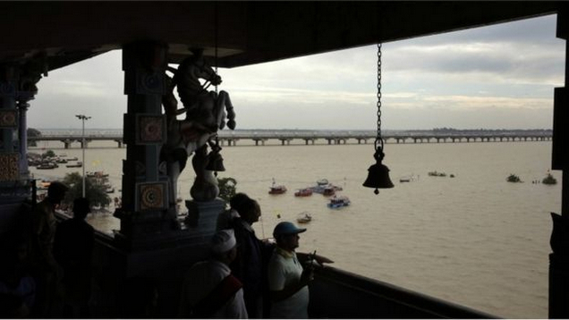
Neighbouring Uttar Pradesh has also been severely affected by floods in the Ganges.
 |
| The holy city of Varanasi has been submerged by the swollen Ganges. AP |
 |
| The Ganges has inundated large swathes of Uttar Pradesh state. AP |
The Indian Meteorological Department, however, has recorded deficient rainfall in these states past week and average rains since the monsoon started in June.
Breaking embankments
Some experts have blamed the silt the river carries for the floods. The Ganges is one of the highest sediment load carrying rivers.
The silt deposition is said to have raised the river's bed-level causing it to break embankments and flood the adjoining human settlements and farmlands.
Officials in Bihar have demanded that an artificial barrier in neighbouring West Bengal state bordering Bangladesh be dismantled to solve the silt problem.
They argue that the deposition of silt has obstructed several passages through the Farakka barrage.
As a result, they say, the Ganges' water flows back to Bihar and causes floods.
Silt deposition has also significantly raised the water level of Kosi river, one of the major tributaries of the Ganges.
 |
| The Ganges is flowing above the danger mark in Uttar Pradesh. AP |
"The silt has raised the river level higher to our villages' grounds, so you can imagine what risks we face."
Chronic problem
The BBC saw silt piling up and threatening to block many of the gates of the barrage on Kosi river, which is built and operated by India in Nepalese territory.
Some geologists say increased incidents of landslides in the Himalayan region have resulted in increased silt in the rivers flowing down to meet the Ganges.
"Since these are alluvial rivers carrying sediment loads, if we can control the silt then we will be able to manage the floods that have become chronic problems in the Ganges basin," said Mr Jha.
 |
| Bihar is one of the worst-affected states. AFP |
 |
| Floods across India have displaced thousands. AP |
"Therefore de-silting of the rivers is the need of the hour and it needs to be done scientifically, from the middle of the rivers," said Professor Anil Kumar Gupta who heads the institute helping the government in geological issues.
Sand mining
Following uncontrolled sand mining from rivers across India for commercial purposes, India's Supreme Court in 2014 ordered a ban on extraction without a licence.
"Such sand mining was mainly done at riversides disturbing the flow of the rivers, therefore the silt will now have to be removed from the middle of the rivers."
India's central water resource authorities, however, believe construction of dams will deal with the problem effectively.
"Non-structural measures like moving people to safe areas have not been effective enough," says Mr Jha.
 |
| The silt deposition is said to have raised the river's bed-level causing it to break embankments. AP |
 |
| The Ganges is the third largest river in the world. AP |
"They have been planned for quite sometime and we are certain that we will be able to build them and solve the chronic problem of floods."
Links

No comments:
Post a Comment