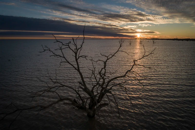
The grim outlook is contained in a slew of draft regional water strategies for major river systems over the next 20 to 40 years, released by the Planning Department. It said it used “the best available evidence including new climate data and updated modelling”.
 |
| An aerial view of the southern Macquarie Marshes during
the height of the recent drought. Image was taken in
August 2019. Credit: Wolter Peeters |
Under a worst-case scenario, for instance, annual volumes in the Peel River are projected to dive by 47 per cent and those in the rest of the Namoi River, into which it flows, would drop by 44 per cent.
|
Murray-Darling Basin  |
| ‘Irrigation hunger games’: Battle over Australia’s food
bowl soon to heat up |
The stark warnings follow renewed alerts this month from the Murray-Darling Basin Authority Authority that flows into the Murray River in the basin’s south had dropped about 40 per cent in the past two decades compared with the average of the century before it.
The state’s findings also raise fresh concerns about the viability of the Berejiklian government’s plan to increase dam capacity or build new ones. For instance, while the government wants to raise the Wyangala Dam wall by 10 metres at a cost that has blown out to as much as $2.1 billion, the regional water strategy for the Lachlan River suggest flows in that system will dwindle.
 |
|
Water  |
| ‘Unacceptable’: Labor joins other MPs to block flood plain harvesting rules |
Upper House independent MP Justin Field said the reports should prompt the government to rethink its approach to managing rivers.
“Water Minister Melinda Pavey spectacularly fails to provide any meaningful plan for dealing with the impacts of this decrease in water availability, instead offering up the same discredited strategies of more dam building and turning our coastal rivers inland,” Mr Field said.
“These climate realities also raise yet more concerns about the government’s plan to licence billions of litres of water for floodplain harvesting in the northern Murray-Darling Basin,” he said. “Issuing these licences based on historical take when we know that water simply won’t be there in the future is a recipe for disaster.”
A spokeswoman for Ms Pavey said farmers and regional communities were on the frontline of climate extremes.“This is the first time any NSW government has embarked on long-term planning for water security and drought resilience.”
Matt Colloff, a former CSIRO scientist now at the Australian National University, said different NSW agencies were producing varying outlooks.
|
Murray-Darling Basin  |
| The fish and bird species at risk from Australia’s failure to manage wetlands |
“Largest increases are evident in the central west through to the northern tablelands. Large reductions in surface runoff are projected in both the near and far future for alpine areas in the south of the state,” it said.
Dr Colloff said the new batch of reports “present no data on range, variation or uncertainty, only the worst case scenario”.
”Call me a cynic, but this says to me they are intended to carry a message that ‘we can’t implement the [Murray-Darling] Basin Plan because of climate change,‘” he said. “And ‘because of climate change, irrigators in the Northern Basin should be allowed to continue with floodplain harvesting’.“
Links
- About the regional water strategies
- Development of regional water strategies
- New climate data and modelling
- Identifying and assessing strategy options
- Community engagement
- Engaging with Aboriginal people
- Regional water strategies previously on public exhibition
- Regional water strategies upcoming public exhibition


No comments:
Post a Comment