
Sydney Morning Herald - Caitlin Fitzsimmons

Years of intense recurring marine heatwaves around Australia’s coast are causing the cyclone danger zone to extend further south to take in Brisbane and northern NSW, with scientists fearing that the tropical storms could one day even threaten Sydney.
Not only is the range of tropical cyclones extending north and south of the equator due to climate change, the storms are expected to be more intense, carry more moisture and move more slowly, causing them to dump more rain over the areas they hit.
In the northern hemisphere hurricanes and typhoons are increasing the risk for major cities such as New York, Boston and Tokyo, as the tropical zone has increased its latitude by 1-2 degrees every decade for the past several decades.
Professor Liz Ritchie, from Monash University and the Australian Centre of Excellence for 21st Century Weather, said there was evidence that cyclones were already moving further south in Australia, and much clearer evidence they were moving further north in the North Atlantic and the Pacific Northwest.

“That could be a function of warmer sea surface temperatures or a function of how we’ve recorded and tracked these things in the past … but they do look like they’re moving further south both off our west coast and off our east coast, as well as in both the South Pacific and the south Indian Ocean.”
Tom Mortlock, head of climate analytics Asia-Pacific at Aon and an adjunct fellow from the Climate Change Research Centre at the University of NSW, said the trends for the past 60 years were unclear, but several climate models suggested a southward shift would occur.
“There are projections that with a warming ocean and a warming atmosphere, that we may see a higher chance of cyclones tracking further south than we have done over the historical period in the future,” he said.
A 2021 peer-reviewed article in Nature Geoscience found that 21st-century tropical cyclones “will most probably occupy a broader range of latitudes than those of the past 3 million years” with a distinct poleward shift.
 |
| Historical tropical cyclone activity across Australia between 1981 and 2017. Credit: Geoscience Australia |
On Tuesday morning Cyclone Alfred was sitting about 500 kilometres to the east of Brisbane and the Sunshine Coast as a category 2 system. The Bureau of Meteorology expects it to gradually move south and then take a sharp turn to the west to make landfall north of Brisbane from late Thursday into Friday.
The worst effects would be south of the cyclone in Brisbane, the Gold Coast and the Northern Rivers, BoM said, including intense winds, rainfall and coastal swells.
Scientists said if the cyclone hypothetically changed direction, it was possible for it to travel as far south as Sydney.
“We actually have sea surface temperatures that are warm enough to sustain tropical cyclones as far south as Sydney at the moment, which is unusual,” Mortlock said.
Mortlock said a cyclone would only form if ocean waters were about 26-27 degrees and it would peter out unless there was also continued marine heat along its path. Australia has a marine heatwave around most of its coastline, a recurring phenomenon every summer for the most of the past decade.
Ritchie said: “If Alfred happened to track down and didn’t make landfall near Brisbane but came down towards Sydney, it could potentially follow that little tongue of warm water and stay fairly intense before it came inland. That is absolutely true but it’s not going to happen [this time].”
A tropical cyclone is a low-pressure system generated in the tropics that gets its energy from warm sea surface temperatures, spins up and then releases that energy as it makes landfall. It is the same type of storm as a hurricane or typhoon, though it spins in opposite directions on either side of the equator.
Alfred
would be first tropical cyclone to impact NSW since Nancy in 1990.
Mortlock said tropical cyclones were usually downgraded by the time they
made landfall in southern Queensland or northern NSW, but the
ex-tropical cyclones or tropical storms were often “messier” with more
widespread impact.
Heating Australia
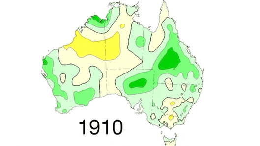
Average temperatures from 1910 to 2024. Bureau of Meteorology
Mortlock said there was also a clear and continuing trend over several decades for a decrease in the number of cyclones making landfall on the Australian east coast, bucking the global trend of more cyclones. However, he said the cyclones that did hit the Australian continent were expected to be more severe.
Ritchie said the risk of cyclones causing floods was increasing because a warmer atmosphere could hold more water and the storms tended to stay in one place for longer, dumping rain in one location. She said this had occurred with Cyclone Jasper in December 2023.
“When we think of severity, we’re often talking about the winds, but it’s one of the important changes that we seem to be already seeing, is the amount of rainfall that can come out of these systems,” Ritchie said.
Links
No comments :
Post a Comment